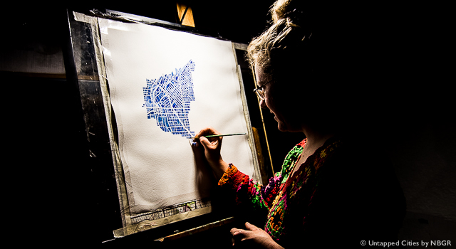
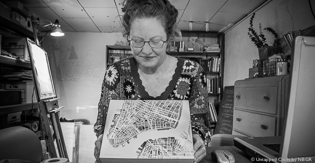
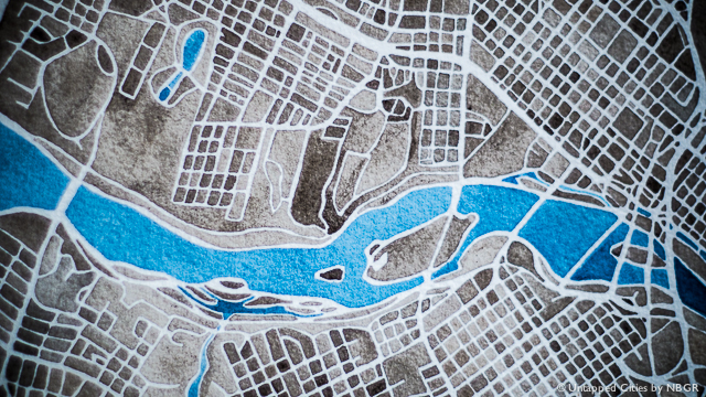
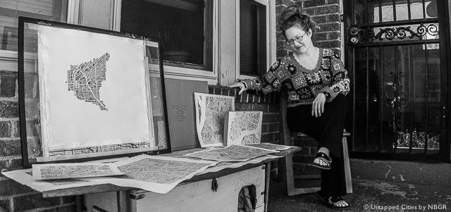
Through a chance encounter on Airbnb, Untapped Cities came in touch with Denver artist Anne McGraw. Her self-funded project, Summit Ridge Studio, consists almost entirely of hand-painted maps that she produces from the basement of her home and sells online by request. Surrounded by her collection of antique maps and two cats, McGraw has developed a cutting edge aesthetic using everyone’s favorite open-source navigation software–Google Maps. We sat down with Anne to talk about her use of water colors, Denver urbanism, and her past as an architect.
Untapped Cities: Give us a breakdown of your collection.
Anne McGraw: I started Summit Ridge Studio in late 2010, and it basically came from people’s suggestions. I had posted a few maps of past work that I had done–both water color and non-water color paintings–and people started offering suggestions for cities they wanted to see painted. When I showed those maps on Etsy and then Pinterest, that’s where the whole notion took off. There was a 10-year gap between when I painted my first map and when I put it online.
Untapped Cities: What did you do during that 10-year gap?
McGraw: I was an architect and had painted just as a hobby. I then moved to Denver after losing my job, sight unseen.
Untapped Cities: What do you think Denver best exemplifies about American urbanism?
McGraw: The shocking thing about Denver that I didn’t realize until I moved out here was how small it is. Denver makes good use of this compactness. It continues to infill rather than spread out. The charm of it is that, suburbs aside, everything exists within an accessible three-mile radius. Other cities that have become really popular–like Houston or Chicago–tend to get so big that they outgrow themselves. When the time comes to paint a city, I have to tell people that I can focus on the downtown, but not many people actually live there in larger cities. People will tell me that they live in Chicago and ask me to paint that, but they actually live in a neighborhood on the edge that won’t turn up as well.
Untapped Cities: What visual or graphic aspects are you focusing on when you paint a city?
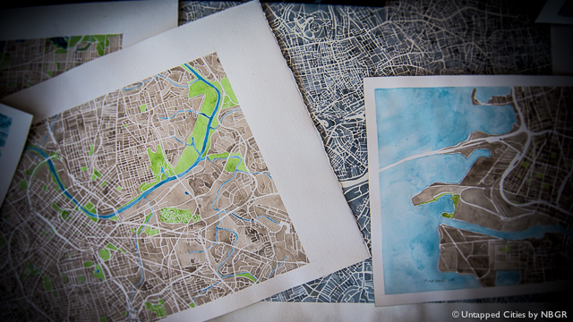
McGraw: I learned a trick that a lot of mapmakers will lay little “easter eggs” in order to put their hidden signature on a map. When I get a commission, I try to ask as much about what is meaningful to that person as possible. At first, I used essentially two colors: a sepia tone and blue for water. A lot of people got interested when I started including green for parks, and that’s become a common request now. Many online maps will highlight different areas as being parks. I’ll switch back and forth between map and satellite views then go back and highlight what I think is a “green space,” even if it’s not considered an official park.
Untapped Cities: How do water colors contribute to your aesthetic?
McGraw: Water colors and architectural renderings go hand in hand. They require you to plan out in advance what you’re going to do, and if you mess up there’s no way to correct that. It might be the architectural background, but I maintain the detail when I use water color with a small brush about the width of a pencil tip, a size 0. I might use the next level up for painting water, but even then it’s no larger than a quarter of an inch. Those areas I can literally get “watery” with the effects. I still have to be very meticulous and intentional with it because I paint vertically.
Untapped Cities: Why do you paint vertically?
McGraw: I bought this easel to do other painting. Now I use it more like a light table with the maps on a sheet of paper, then water color paper atop that. I have more freedom with the easel, as I can stand or sit and angle it any way I want. To make everything stand out, I trace over the map with sharpie and I color code it from there.
Untapped Cities: What do you think of technology’s increasing role with maps and fine arts?
McGraw: There were times where I thought that I could do just a Photoshop water color, but I can’t bring myself to do it. Even with color correction, when someone asks for a blue palette instead of sepia and they ask if I can do it on the computer, I say, “Sure,” but it just wouldn’t be the same. If that happened enough I would just get dependent on Photoshop, which would be sad. I don’t get as lost in my head with the love of the city when I mess around with Photoshop.
Untapped Cities: How many of the cities that you’ve painted did you visit before you painted them?
McGraw: A lot…more so than not. When I painted Charleston I attracted a lot of Southerners who wanted me to paint another Southern city. I had lived in the South for 30 years and had been to most of the places that people were requesting. The more cities I painted, the more search results I would attract from people in those areas. Most of my requests come from the first paintings I did of Mississippi and Colorado.
Untapped Cities: How important is it for you to get to these cities before you paint them?
McGraw: Good question…because I can rely on people to give me the information necessary to paint. I have a limited color palette, and it’s not a very determining factor in the final painting. Maybe the biggest changes would be the composition and scale–what parts of the cities I include and focus on. If the city has a good composition I’ll do it. A river running through the center always draws my attention. Richmond was interesting in this way, as the river really determines the composition of the city.
Untapped Cities: Have you found a community of “mapcolytes” online that share your passion for maps?
McGraw: I haven’t. I don’t know if I’ve actually looked for that. When I started figuring out if I could do this, I read a lot of artists’ blogs. That was the mental kick that I needed, because some stressed that you don’t always have to surround yourself with artists or even other people that enjoy maps. You can think of it more as a business and emphasize marketing yourself. That really ignited my passion for all of my work, and it keeps me going.
Untapped Cities: Is there a message with your art?
McGraw: I don’t know if it’s a message so much as it is the feelings and memories associated with those places. This started as a way to remember my travels. The whole idea of signifying certain aspects of a city is really a part of the process only. When I look back on these paintings years down the line its the memories and the emotions associated with them that stick out. And I think this is the trick for other artists, too.
Get in touch with the author on his Twitter or check out more photos from this interview on his website, thisisnotreale.com.
