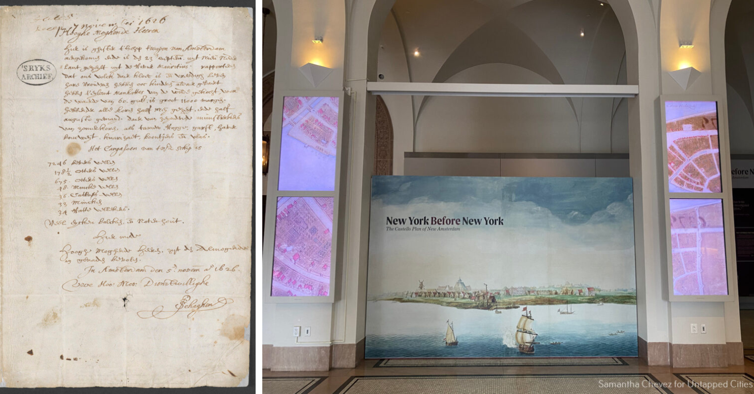
Before Manhattan was the bustling, skyscraper-filled metropolis we know today—before it was even a British colony—it was a Dutch settlement. To mark the 400th anniversary of this settlement, The New-York Historical Society presents New York Before New York: The Castello Plan of New Amsterdam, a new exhibit centered around a 1660 map of the European colony. In addition to the map, never-before-displayed artifacts and documents illustrate a broader view of life in New Amsterdam, one that includes the stories of Indigenous and African people alongside European settlers. With input from modern-day Lenape communities, curator Russell Shorto, director of the New Amsterdam Project and author of The Island at the Center of the World, tells a new story about the earliest days of Manhattan.
Join untapped New York Insiders for a guided tour of the new exhibit, along with highlights from the permanent collection of the New-York Historical Society, on April 13th! This tour is free for Untapped New York Insiders. Not a member yet? Become an Insider today with code JOINUS and get your first month free.
The first colonists set sail for New Netherland, a colonial province established by the Dutch West India Company, in 1624. The colony consisted of parts of present-day New York City, Connecticut, Long Island, and New Jersey. Fort Amsterdam, a stronghold at the southern tip of Manhattan, was the seat of power. It stood where the Alexander Hamilton U.S Customs House, home to the National Museum of the American Indian, stands today. This site is also known as the spot where the contentious “sale” of Manhattan took place.
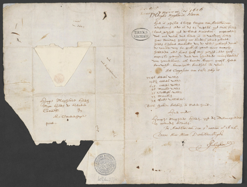
A nearly 400-year-old letter on loan from the Dutch National Archives in the Hague is one of the highlights of New York Before New York. The letter, written by Dutch government official Pieter Schagen, documents the “purchase” of Manhattan. In it, Schagen writes, “our people…have purchased the Island Manhattes from the Indians for the value of 60 guilders.” The value of 60 guilders was estimated to be $24 by 19th-century historians and thus the notion that Manhattan was “purchased” from the Native Americans for $24 has been the narrative told. There are no other documents that record the “sale.”
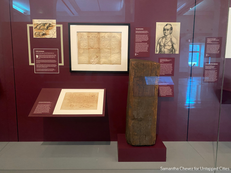
The letter, which is not on public display at the Hague, is on view at the Historical Society alongside a modern-day note from three chiefs of contemporary Native communities: the chiefs of the Ramapough Munsee Lenape Nation and Nanticoke Lenni-Lenape Tribal Nation in New Jersey and the Munsee-Delaware Nation in Ontario. In their note, the chiefs refuse the “sale” and assert, “That letter does not remove our connection to the land and waters of Manahahtáanung.” It is signed, “We are still here,” dispelling the notion that Native American communities solely exist in history books.
Native people of the 17th century would not have interpreted the “sale” in the same way as the European settlers. The two cultures had widely different views on land ownership. The 60 guilders would have been taken as a gift to seal the deal, not as a “purchase” price. The Natives would have seen the deal as a temporary land-use agreement, one that would need to be renewed on a recurring basis.
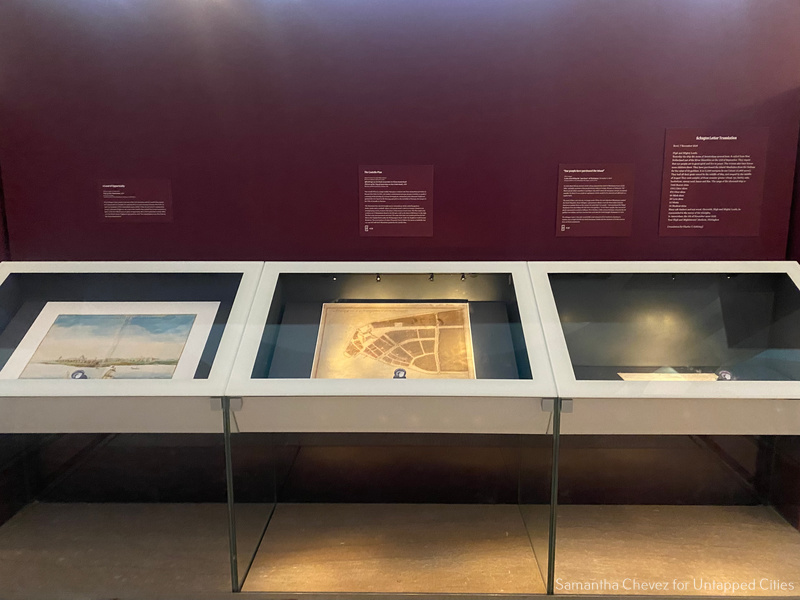
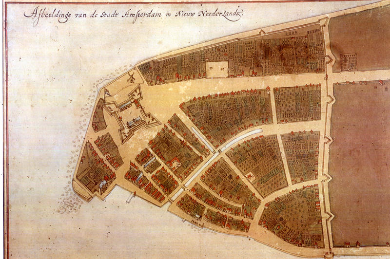
The eponymous map in the exhibit is one of the earliest known maps of New York City. It shows a vibrant colony of approximately 1,500 people at the height of New Amsterdam. Jacques Cortelyou of Dutch West India Company created this map 1660. Although the original plan is lost, an unknown draftsman made a manuscript copy around 1665. This copy was then sold by cartographer Joan Blaeu to the Grand Duke of Tuscany Cosmio II de’ Medici. The map resurfaced over 200 years later in 1900 at Villa di Castello. The manuscript is on loan to the New-York Historical Society from the Biblioteca Medicea Laurenziana in Florence, Italy.
Within the Castello Plan, New Yorkers can see present-day New York City streets that belonged to the original Dutch street grid. The grid of Lower Manhattan is New York City’s largest landmark. A 3D version of the map in the exhibit allows viewers to Zoom in and walk the streets, passing by some of the 300 houses, landmarks like Fort Amsterdam and City Hall, canals, windmills, and farms. You can walk the streets of the Castello Plan while tracking down relics of the colony on Untapped New York’s Remnants of New Amsterdam walking tour!
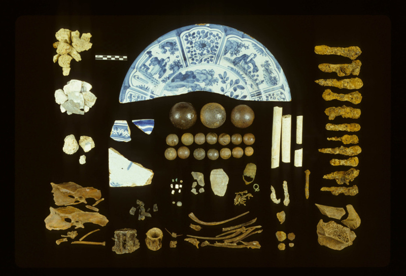
Another highlight of the installation comes from an archeological discovery made on present-day Pearl Street, outside the home of Cornelis Van Tienhoven, Peter Stuyvesant’s secretary. The collection of “bone and shell fragments, marbles, nails, pieces of pipe stems and bowls, glass beads, a copper thimble, and other items” on display is believed to have been part of a mpungu created by an enslaved person. The word “mpungu” means “stick together” and refers to a collection of items believed in central African culture to have healing powers. These items, found in 1984, have never been on display.
Also on view in the exhibit are the watercolor View Of New Amsterdam, wedding rings that belonged to ancestors of the founders of the New-York Historical Society, a remnant of Peter Stuyvesant’s pear tree, and “Dutch Lion Dollars” which represent the currency during New Amsterdam. New York Before New York: The Castello Plan of New Amsterdam is on view through July 14.
Next, check out 10 Secrets of the New-York Historical Society and join us on an upcoming Remnants of New Amsterdam Tour!


