
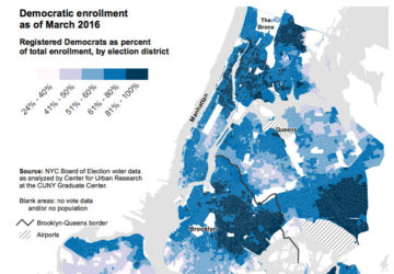
Next week is NYC's Presidential Primary and these maps from the Center for Urban Research at CUNY show where Democrats and Republicans are located in the city.
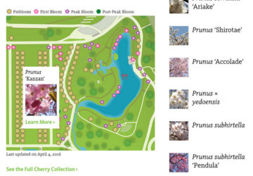
2016 is the 35th anniversary of Sakura Matsuri, the cherry blossom festival at the Brooklyn Botanic Garden. A map helps you track the bloom state of the trees.
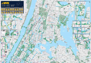
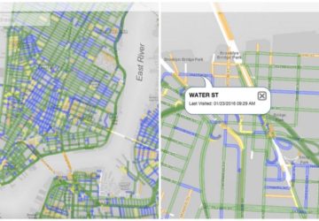
The New York City Department of Transportation has released its annual bike map for 2016, both digitally and with a circulation of 375,00 hard copies
NYC's drinking water is one of the best in the country, but it doesn't mean that issues don't occur. A Columbia University class mapped out open data for water.
WNYC reports with a fun interactive map about NYC's film locations, the number of scripted television shows filmed in NYC has quadrupled since 2002.
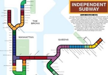
A fun map of the IND (Independent Subway) System in NYC, if its map had been colored per a coding system by Squire J. Vickers denoting express and local.
The website "Placing Literature" is a map-based, crowd sourced platform that locates literary scenes from books in real-life locations all around the world.
With Citi Bike topping 10 million rides in 2015, data analyst Todd W. Schneider takes a deep dive into open data, showing all trips on one day of the system.
NYC.gov has a useful map, PlowNYC, tracking real-time street plowing in all 5 boroughs of New York City, updating every 15 minutes.
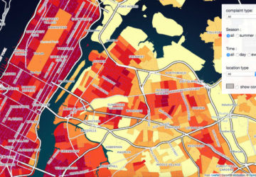
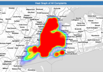
A 311 noise complaint map and dashboard by CartoDB from data in NYC in 2015. New Yorkers complain more in winter and have a hatred of ice cream trucks.