


10. Clove Road
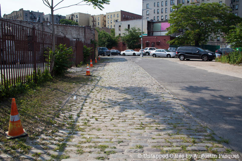
In the midst of the street grid in Crown Heights is an odd diagonal midblock street known as Clove Road. Located behind an A&P supermarket, it’s so forgotten the Google Street View car didn’t even bother to turn down it. Yet, it may have one of the richest and longest histories of any street in the neighborhood.
Clove Road is what remains of a Native American trail and later Colonial era road and it retains some of its old Belgian blocks to boot. (Belgian block, rectangular pieces of granite that came from ship ballast, is commonly miswritten as cobblestone but the two are actually different.) Architect Michael Cetera, who has studied Clove Road in depth, says it was also an important location in the American Revolutionary War and was one of the first roads in Brooklyn to be paved. It was also possibly a portion of, or nearby, the Bedford Pass, which allowed passage through a ridge that is today’s Eastern Parkway. American troops used this pass to retreat back to Brooklyn Heights during the Battle of Brooklyn.
The name clove comes from the Dutch kleft, meaning a cleft between two hills that have since been flattened. Clove Road was originally much longer, running from present day Fulton Street to Empire Boulevard, after which it was known as Canarsie Avenue. As Kevin Walsh from Forgotten New York explains, Clove Road was likely intended to be eliminated when the new street grid was laid out but this section, between Montgomery Street and Empire Boulevard, somehow lingered on.
Join us on our next tour of the Secrets of Prospect Park!