
8. Whitehall Street
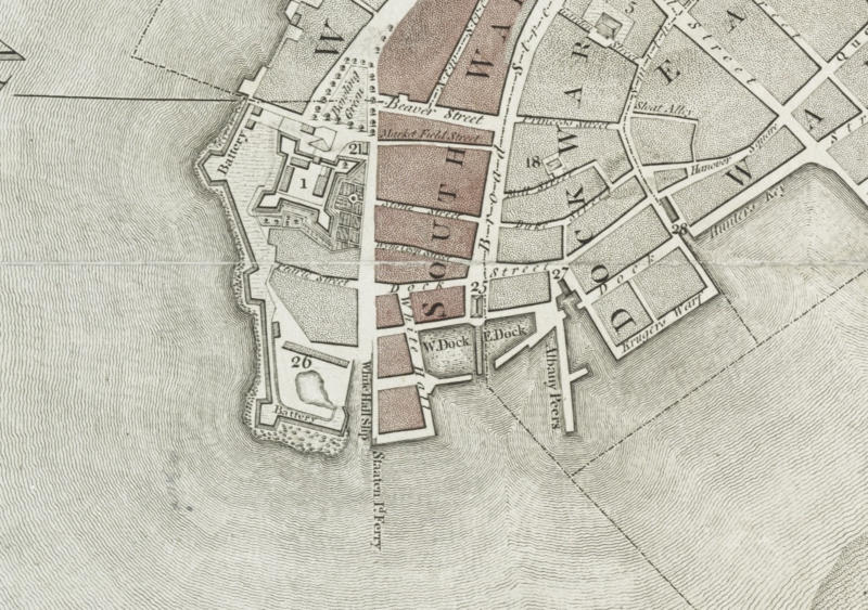
The street known to New Yorkers today as Whitehall Street was part of Het Marckvelt Steegie in New Amsterdam. The road dates to approximately 1626 when it was the site of a Dutch livestock market. The name was changed to Whitehall in the 1680s when English colonial governor Thomas Dougan built a mansion adjacent to the street and called it Whitehall after the London palace occupied by English kings from Henry VIII to William III.